Wildfires
RVEM
Fire is a natural element in forest ecosystems. Today, more people are taking up residence in the forests and rangelands - and thus becoming part of the wildland/urban interface - where the urban environment meets the wild. Residents living in wild land/urban interface areas should be aware of the danger of wildfire and prepare accordingly.
There are basically three ways that structure fires ignite from forest fires:
- When fire reaches such intense radiant heat that a nearby combustible starts burning.
- When the fire burns right to an object or right to the structure, causing the flames to directly touch and ignite something that will burn.
- When fiery embers, also known as firebrands, fly through the air and land on the structure or combustibles, starting a fire.
The Home Ignition Zone (HIZ)
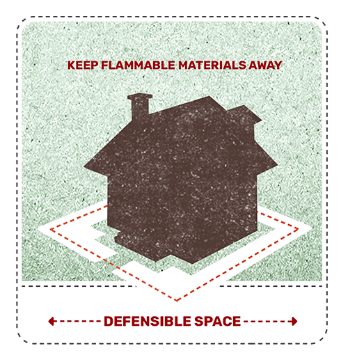
The HIZ includes your home and the immediate area surrounding your home, up to 200' from the home depending on terrain and vegetation. Keeping your HIZ as fire-safe as possible will reduce the chance that your home will ignite during a wildfire.
Your Home:
- Replace wood shake roofs with non-flammable roofing material.
- Remove leaves and needles from gutters, roofs and decks.
- Remove tree limbs that hang over the roof.
- Keep decks free of flammable lawn furniture, door mats, etc.
- Screen vents and areas under decks with 1/8" metal mesh to keep embers from getting in your house.
- Store firewood in a safe location - at least 30 feet away from your home and deck.
Within 30 Feet of Your Home:
- Maintain 30 feet around your home - lean, green and clean. Remove dead vegetation and keep dry grass trimmed to 4 inches tall.
- Plants directly near the home should be carefully chosen (ideally they should be of a fire-resistant nature) and maintained (well-watered and free of dead materials that could ignite during a wildfire).
- Flammable brush Juniper, for example) should be removed.
Within 100 Feet of Your Home:
- Remove dead plants and brush.
- Remove low branches from trees and shrubs.
- Mow grass to 6 inches.
- Tree crowns should be spaced 10-15 feet apart to avoid dangerous crown fires.
- Driveways leading to the home should also be clear of heavy vegetation on either side and should be wide enough to accommodate fire-suppression vehicles and personnel.
Be Prepared: Wildfires and High Wind Emergencies
Emergencies like wildfires and high winds can strike with little warning, posing significant risks to lives, property, and communities. Being prepared and knowing how to respond can make a crucial difference in ensuring safety and reducing damage. Here’s how to prepare for these types of emergencies:
Understanding the Risks
Wildfires: These are uncontrolled fires that spread rapidly through vegetation, fueled by dry conditions, wind, and other factors. They can destroy homes, infrastructure, and natural habitats within minutes.
High Wind Emergencies: Severe wind events, such as hurricanes, tornadoes, or strong local windstorms, can cause extensive damage by toppling trees, power lines, and buildings. They may also exacerbate wildfire risks by spreading flames quickly.
Preparing Your Emergency Plan
-
Stay Informed: Monitor local weather reports and emergency alerts regularly. Sign up for emergency notifications from local authorities to receive timely updates.
-
Create a Family Emergency Plan: Develop and practice an emergency evacuation plan with your family. Identify multiple evacuation routes and designate a meeting point in case you are separated.
-
Prepare an Emergency Kit: Include essentials such as water, non-perishable food, medications, flashlight, batteries, first aid supplies, and important documents (e.g., insurance papers, identification).
-
Protect Your Property:
- Clear Defensible Space: Remove dry vegetation and debris from around your home to create a defensible space.
- Harden Your Home: Use fire-resistant materials for roofing and siding. Install fire-resistant shutters or drapes.
-
Secure Outdoor Items: Anchor or store outdoor furniture, decorations, and other items that could become projectiles in high winds.
During an Emergency
-
Follow Authorities’ Instructions: If instructed to evacuate, do so immediately. Take your emergency kit and follow designated evacuation routes.
-
Stay Indoors During High Winds: If indoors during high winds, stay away from windows and exterior walls. Seek shelter in a basement or interior room.
-
Monitor the Situation: Stay informed about the progress of the emergency through local news, radio, or official updates.
After the Emergency
-
Assess Damage Safely: Only return home when authorities declare it safe to do so. Be cautious of hazards such as downed power lines, weakened structures, and hot spots from wildfires.
-
Check on Neighbors: Help neighbors who may need assistance, especially those with disabilities or who are elderly.
-
Contact Your Insurance Company: Begin the process of documenting and filing claims for any damages to your property.
Conclusion
Being prepared for wildfires and high wind emergencies requires foresight and planning. By understanding the risks, creating a comprehensive emergency plan, and staying informed, you can protect yourself, your loved ones, and your property. Remember, preparedness is key to minimizing the impact of these emergencies and recovering quickly afterward.